
Haw Contemporary
1600 Liberty Street
Kansas City, Missouri 64102
816.842.5877
Haw Contemporary
1600 Liberty Street
Kansas City, Missouri 64102
816.842.5877
Grossman’s painting, Blue Meander Sketch, was featured on the recently published book, Riverine Dreams, Away to the Glorious and Forgotten Grassland Rivers of America, by Lawrence author, George Frazier, and several of her aerial photographs of prairie rivers were included inside.


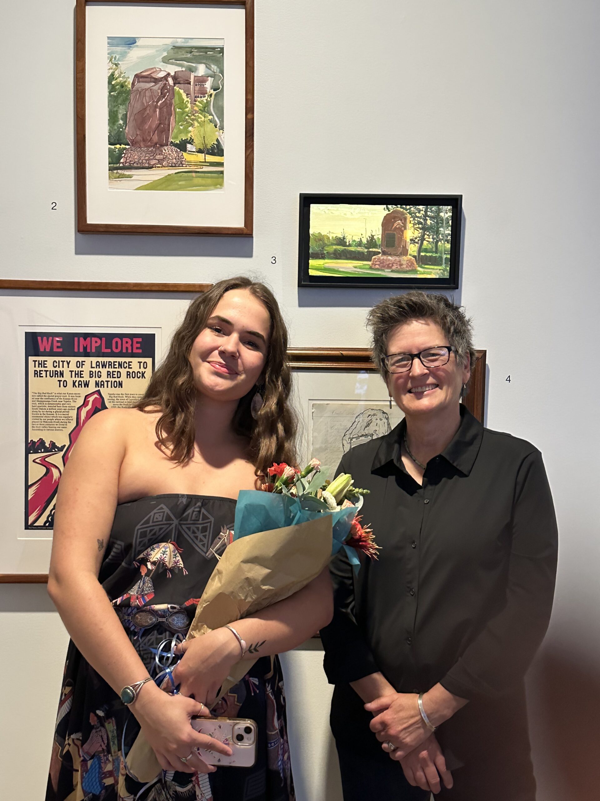
Grossman joined curator Sydney Pursel and fellow artists Dave Loewenstein, Kylie Mehojah, Karl Ramberg, and Tommee Sherwood, for a panel discussion about their work created for the Sacred Red Rock project. The artists were featured in “In’zhúje’waxóbe: Return of the Sacred Red Rock” , an exhibition at the Spencer Museum of Art.
Thursday, November 13, 2025, 6 – 7 pm
Spencer Museum of Art
The University of Kansas
1301 Mississippi Street
Lawrence, KS 66045

The Spencer Museum of Art opened an exhibit based on the rematriation of Iⁿ‘zhúje‘waxóbe, the Sacred Red Rock, to Allegawaho Park near Council Grove, Kansas. The exhibit features work by Native and non-Native artists primarily produced in community workshops in Lawrence, Kansas, that explored the historical and cultural significance of the the rock to Kaw Nation and the rematriation process. In 1929 it was removed from it’s original location at the confluence of the Kansas River and the Shunganunga River near Topeka, and turned into a monument commemorating the founders of Lawrence.
Grossman created three works, an oil and two watercolors, of Iⁿ‘zhúje‘waxóbe during a Sacred Red Rock workshop on July 23, 2023, in Robinson Park, a day before the area was fenced off in preparation for the rock’s removal. Two of those works were on display in the exhibit.
September 9, 2025–January 25, 2026
Larry & Barbara Marshall Family Balcony
Spencer Museum of Art
The University of Kansas
Lawrence, Kansas


New Prairie Work opened Friday, August 1, 2025, and ran through September, 27, 2025.
SNW Gallery
328 Poyntz Ave.
Manhattan, Kansas 66502

Grossman was the Keynote Speaker for the annual Kansas Land Trust fundraising event on Thursday, June 12, 2025, at the Cider Gallery, Lawrence, Kansas.

Symphony in the Flint Hills celebrated its 20th anniversary and hosted its Grande Finale “Prairie Sunset” Event on June 14, 2025, in Chase County, Kansas. Lisa contributed artwork to their benefit art auction every year and “Across the Prairie Watershed” was my entry for 2024. The painting was an oil on canvas, 24 x 30 inches, painted earlier in the year. It received “BEST IN SHOW” by juror, Diana Werts.
The Symphony in the Flint Hills mission has always been to “heighten appreciation and knowledge of the Flint Hills tallgrass prairie.” The annual Field Journal has always been integral to the event and celebrates the Flint Hills ecoregion and culture through art, science, history, and essays. Lisa’s work was often included in the publication.
Online bidding for the art auction and the in-person exhibit ran from Saturday, April 26, through Tuesday, June 17, 2025.
Go to the website for more information: symphonyintheflinthills.org

Grossman’s painting, River Mile 104 – Mill Creek on the Kaw, was acquired by the museum for their permanent collection. The 52 x 60 inch oil on canvas debuted in Grossman’s solo show, On the River, at Haw Contemporary in 2024.
Marianna Kistler Beach Museum of Art
701 Beach Lane
Kansas State University
Manhattan, KS 66506

Grossman showed new Kansas River paintings at Haw Contemporary Friday, September 27 through November 2, 2024, in the Stockyards District of Kansas City, Missouri.
Haw Contemporary
1600 Liberty Street
Kansas City, MO 64102


Symphony in the Flint Hills hosted their signature event on June 8, 2024, Red Ranch, Greenwood County, Kansas.
“Solstice Eve,” a 9 x 36 inch, oil on canvas with a black floater frame, was Grossman’s entry in the Symphony in the Flint Hills benefit auction and exhibit. The non-profits’ mission is to heighten appreciation and knowledge of the tallgrass prairie ecosystem and culture.
Over 80 artworks were on display at the Symphony in the Flint Hills at the gallery in Cottonwood Falls, Kansas.
